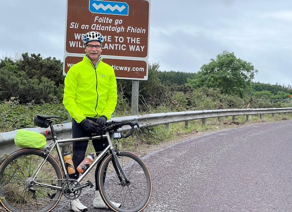
The Wild Atlantic Way is a 2000+ km route that traces the west coast of Ireland from Kinsale, County Cork, in the south, to Muff, County Donegal, in the north (or vice versa).
What follows is an account of my cycle along the Wild Atlantic Way in June 2024 over 22 days (with two rest days), covering 1830 km, ascending 18,890 metres, and spending 86 hours in the saddle (and several more trying to figure out which turn to take next). Apart from just one day, the weather was amazing, and I would do it all again in a heartbeat.
Heartfelt thanks to Keelin, who drove the support car and provided encouragement along the way: I couldn't have done it without you.
|
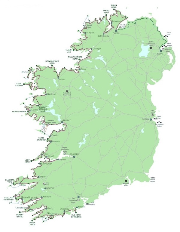
Image credit: www.failteireland.ie Click here for a high resolution version of this map.
|
|
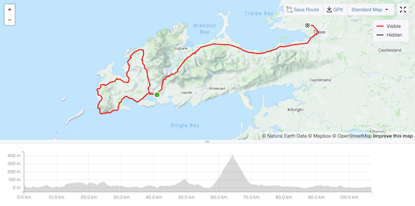
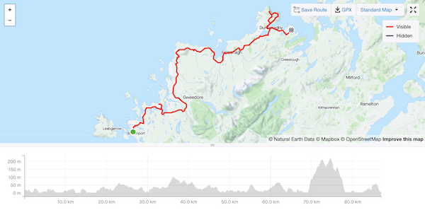
4 June 2024
95 km - 1209 m - 5' 23"

Image credit: www.failteireland.ie
Here is the ride on Strava.
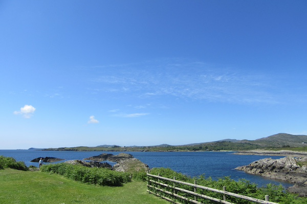
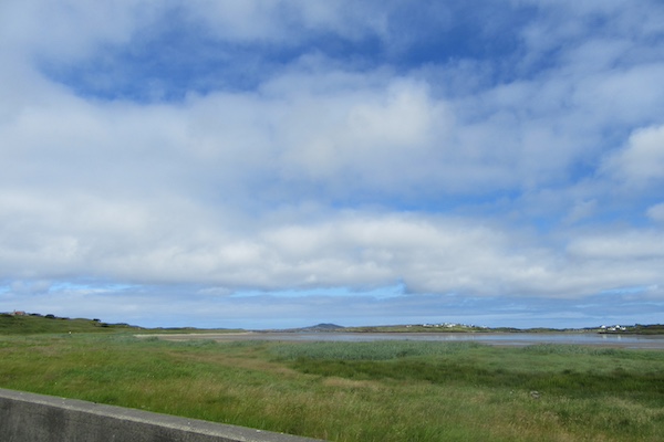
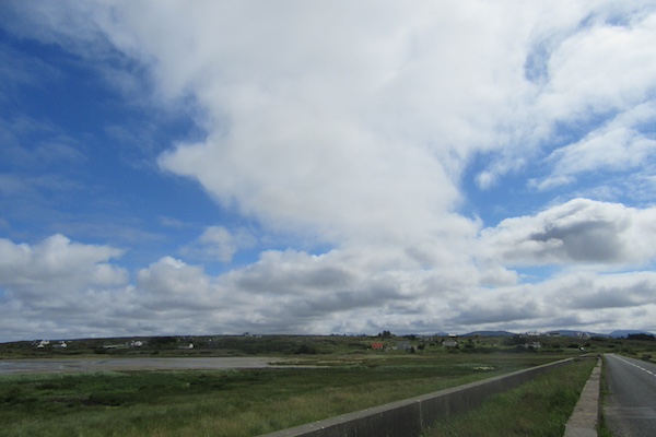
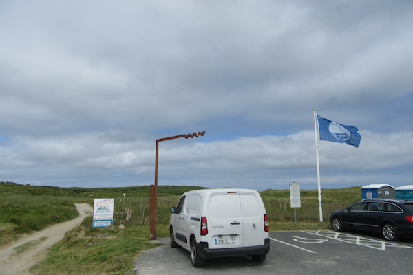
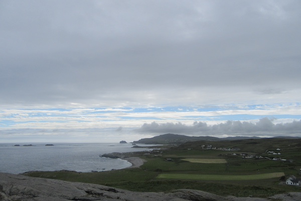
The start of the Wild Atlantic Way just east of Kinsale.
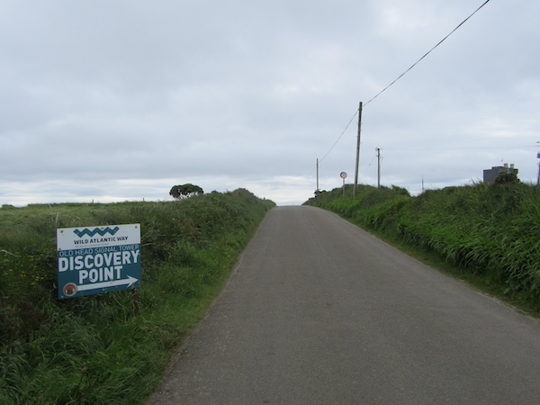
Almost at the first discovery point at the Old Head of Kinsale.
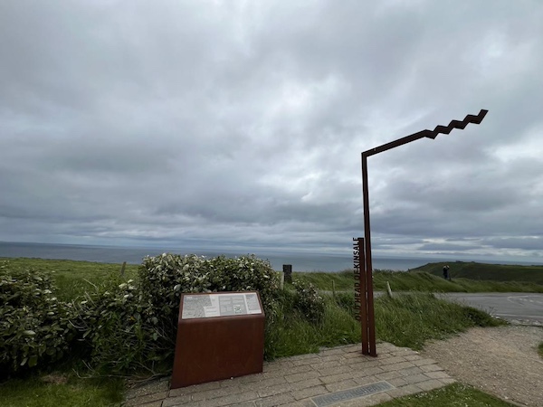
The first discovery point at the Old Head of Kinsale.
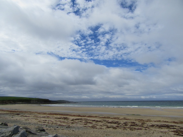
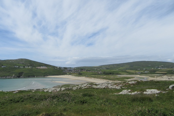
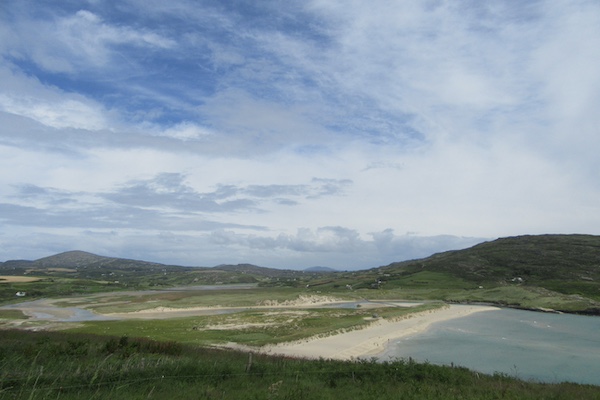
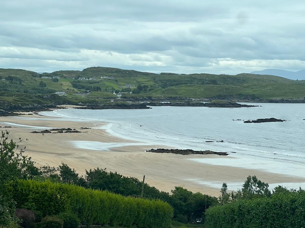
The beach at Garretstown.
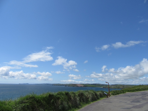
Approaching Galley Head View.
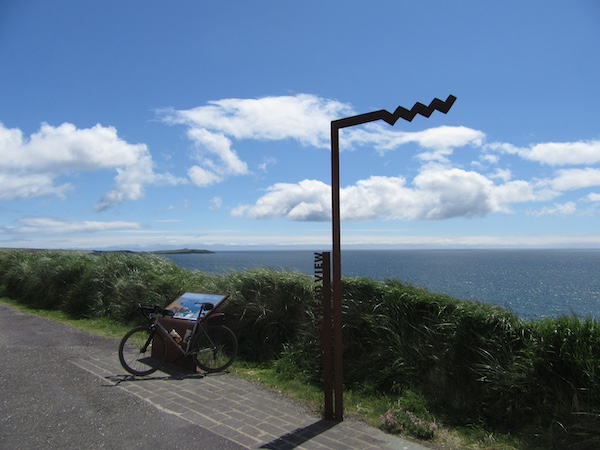
Galley Head View.
Happy to be done for the day.
5 June 2024
106 km - 1113 m - 5' 13"

Image credit: www.failteireland.ie
More headwinds and hills, but much better signage and roads made this a long but enjoyable ride. The 12-31 cassette made all the difference, as did the 25 mm tyres.
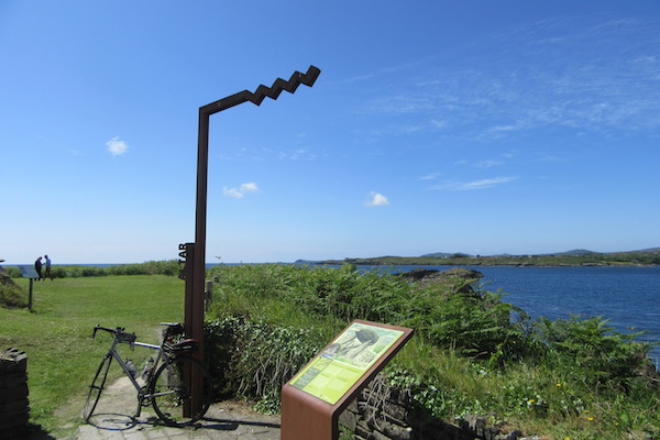
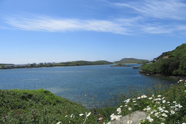
The route took me to places I had not been to for at least 40 years: Schull, Crookhaven, Barley Cove, and Mizen Head, the most southwestern point on Ireland and the counterpoint for Malin Head, the northernmost point, where I was eventually headed.
Here is the ride on Strava.
Altar, on the way to Mizen Head.
Altar, on the way to Mizen Head.
Altar, on the way to Mizen Head.
Approaching Barleycove, on the way to Mizen Head.
Approaching Barleycove, on the way to Mizen Head.
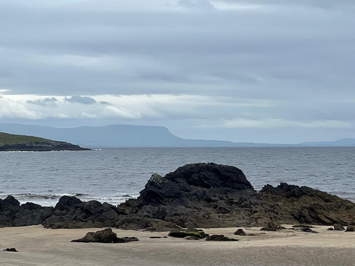
Barlycove, on the way to Mizen Head.
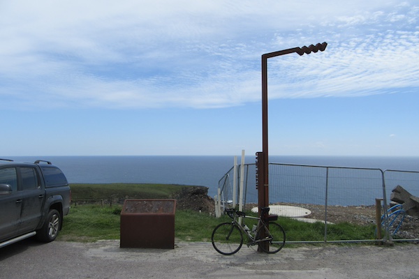
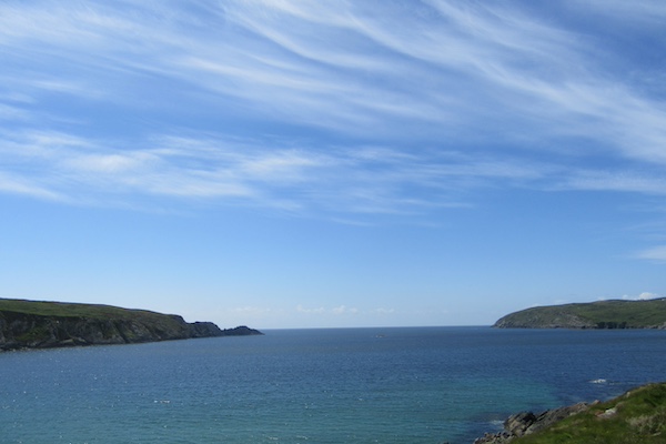
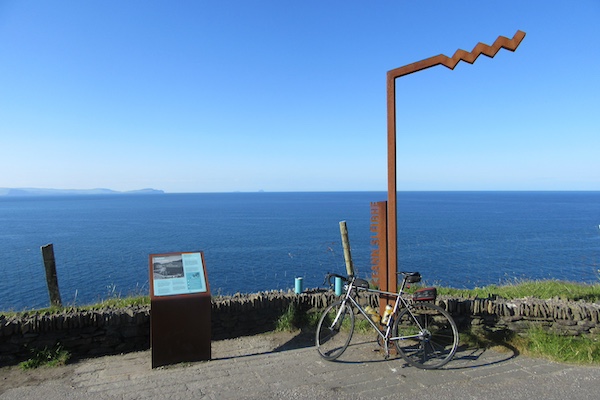
Mizen Head.
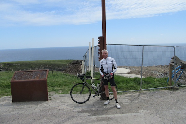
Mizen Head.
Barlycove, on the way back from Mizen Head.
Approaching Barlycove, on the way to Mizen Head.
Approaching Barlycove, on the way to Mizen Head.
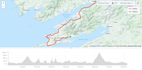
6 June 2024
69 km - 871 m - 3' 27"

Image credit: www.failteireland.ie
Yet more headwinds and hills (spot the trend?), with a short steep climb to get the day started. Not so many photos as the high hedgerows along most of the route hid the views.
Here is the ride on Strava.
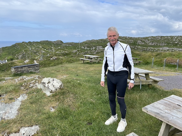
Getting ready to set off.
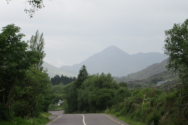
Seefin View, at the top of the first ascent.
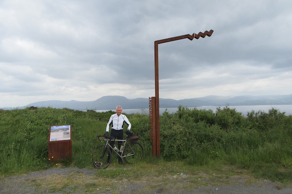
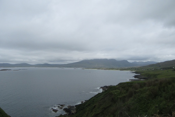
Starting the Beara Peninsula, just west of Glengarrif.
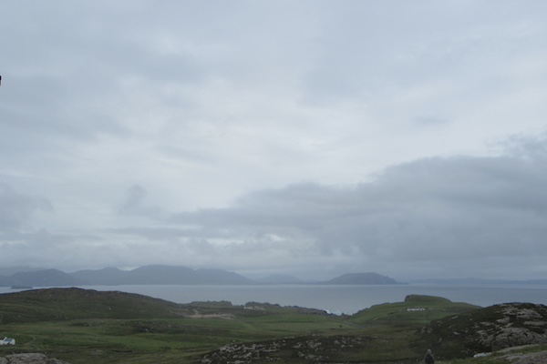
The view from the Beara peninsula across to Sheep's Head peninsula, where I started this morning
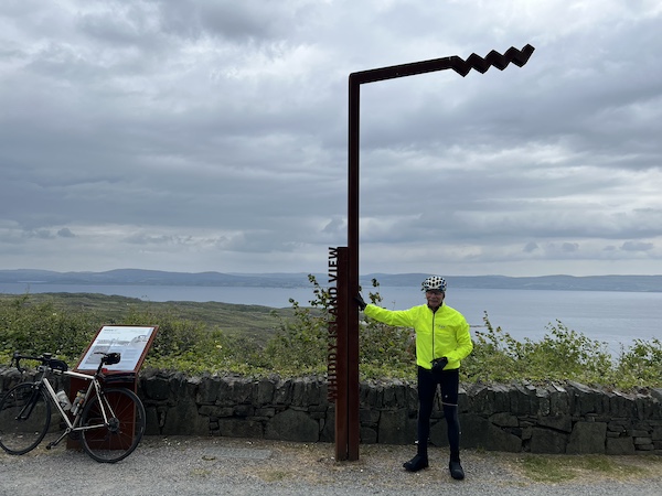
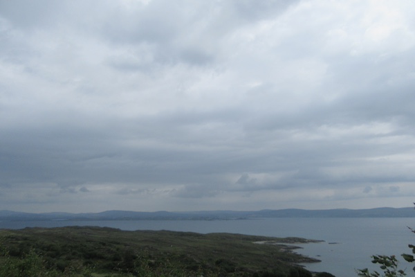
Whiddy Island View.
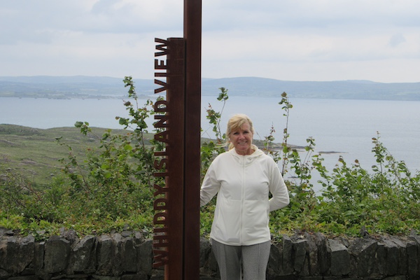
Keelin, who is driving the support car, at the Whiddy Island View.
7 June 2024
82 km - 1131 m - 4' 10"

Image credit: www.failteireland.ie
Inevitably, more headwinds and hills, and the hills were the steepest yet (14%) leaving Allihies as the route turned north east. Not just one ramp, but many. The reward was a super descent with a following wind. Cycling doesn't get better than this. The videos below give you a small taste of the experience.
Here is the ride on Strava.
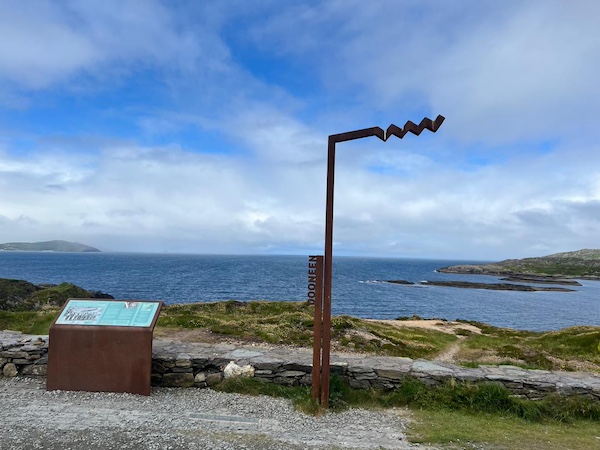
The view west at Dooneen viewpoint, after surviving the hills just north of Allihies.
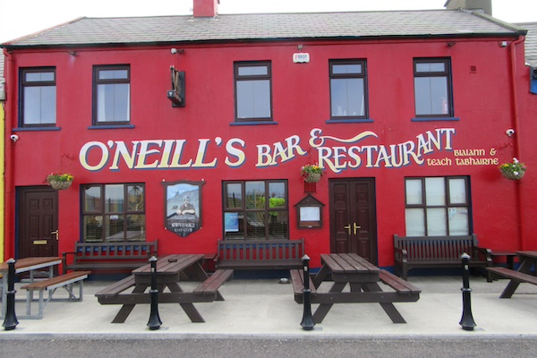
Leaving Allihies ... Keelin is an O'Neill so I had to take this photo.
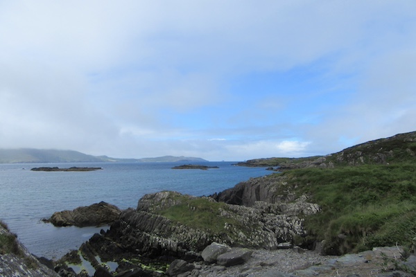
Another view west after leaving Allihies.
Yet another view west after leaving Allihies.
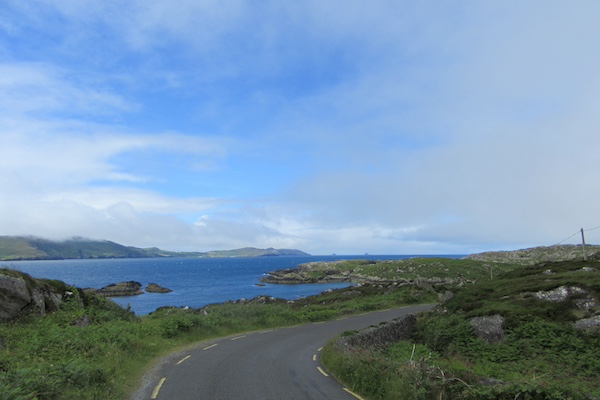
The descent after the climbs out of Allihies.
Another descent after the climbs out of Allihies.
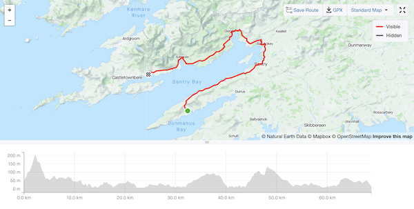
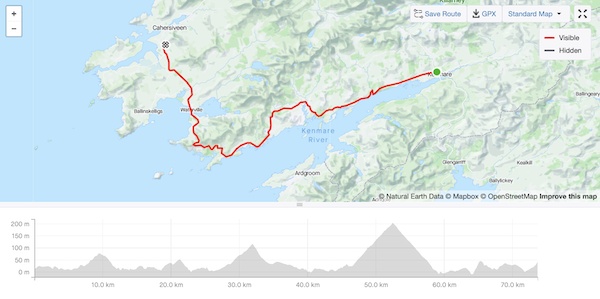
74 km - 814 m - 3' 33"
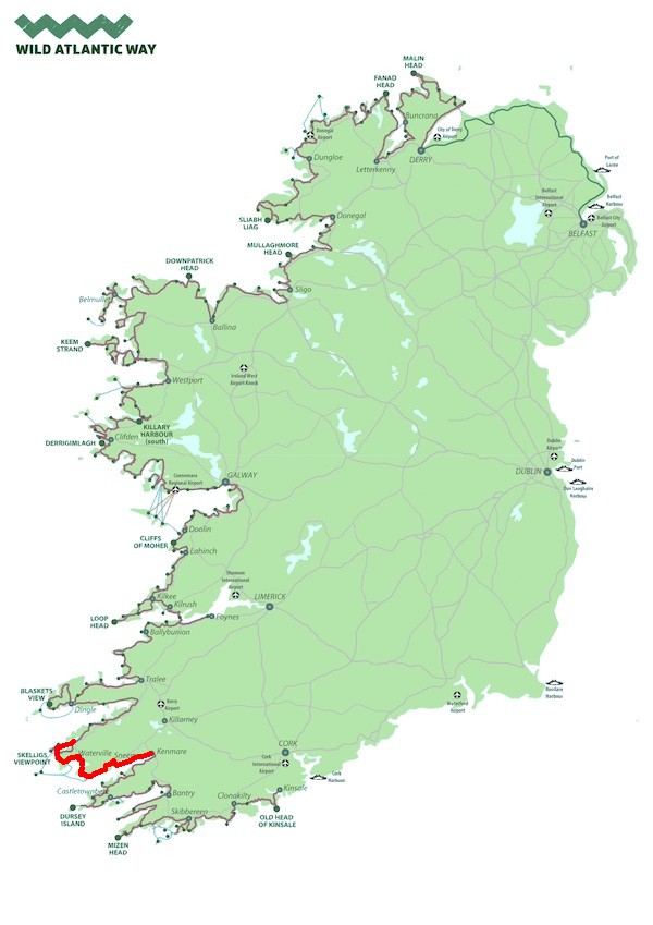
Image credit: www.failteireland.ie
A shorter day today (I skipped the Skellig Ring as I approached Cahersiveen) and there were just two reasonable climbs ... after the hills north of Allihies, all climbs from now on will be described as reasonable.
I got lucky with the wind. I was expecting a serious headwind all the way but it turned to a (cold) northerly cross-wind and I made good time out of Kenmare. Let's see what tomorrow brings, going back east-north-east to Kilorglin and Castlemaine, and then ... hold your breath ... due west into the Atlantic to Dingle when, one way or another, there will be a killer of a headwind, but the promise of a rest day to follow.
But tomorrow isn't here yet and, in the meantime, we're in Cahirsiveen enjoying the amazing hospitality of Mary, Eileen, and Liam (who we met, thanks to Patti, on a cycling trip in Rwanda).
Here is the ride on Strava.
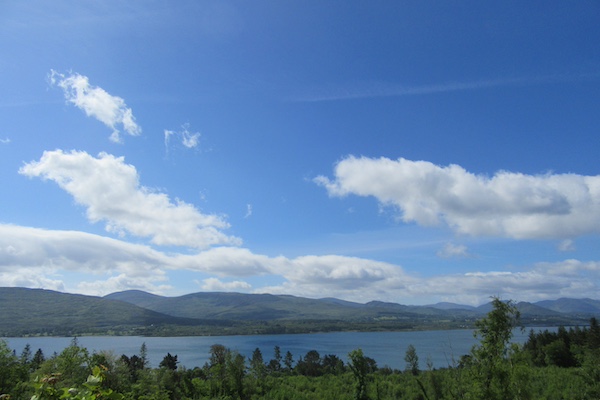
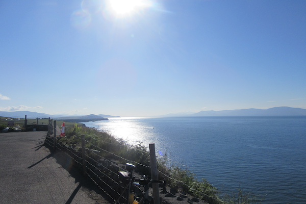
One of many vistas as you head west out on the Ring of Kerry.
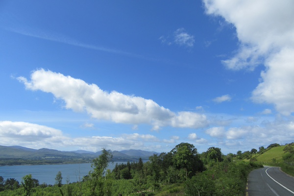
And more ...
And more again ...

Gaining altitude now.
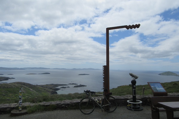
At the top of a longish but managable climb up to Com an Chiste, where the wind would blow you across the road (almost did on one bend on the descent).
Entering one of Ireland's Gaeltachts, regions where the Irish language (Gaeilge) is the normal spoken language.
Early in the ride, heading west out of Kenmare.
9 June 2024
98 km - 897 m - 4' 32"

Image credit: www.failteireland.ie
Today's ride was as expected. I caught a tailwind out of Cahirsiveen all the way to Glenbeigh, and then it dropped a little as I continued east-north-east to Castlemaine. Then, turning west on the south shore of the Dingle peninsula, the cycling gods do what they do and bring you back to earth with a bump: 44 km of strong headwinds all the way to Dingle. Tomorrow is a rest day, which I intend to use carb-loading and catching up on email.
Here is the ride on Strava.
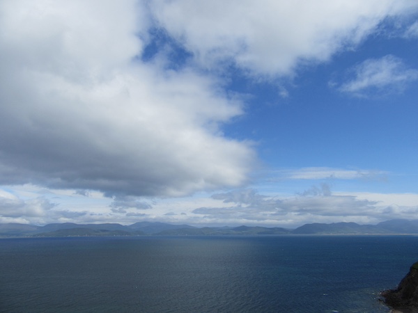
The view north from the Ring of Kerry as you travel east-north-east from Cahirsiveen. The headland in the distance is the Dingle peninsula which is where I'm headed.
And more of the same.
This is Mountain Stage. You can read about it in the next photo.

Mountain Stage (Apologies if this takes time to load: I used the original high-resolution image so that you can read the text.)
A nice touch on the wall beside the Mountain Stage sign ...
More looking north to where I'm going today.
And more ...
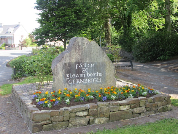
Finally, Glenbeigh. It's nice to see the old Irish script still being used.
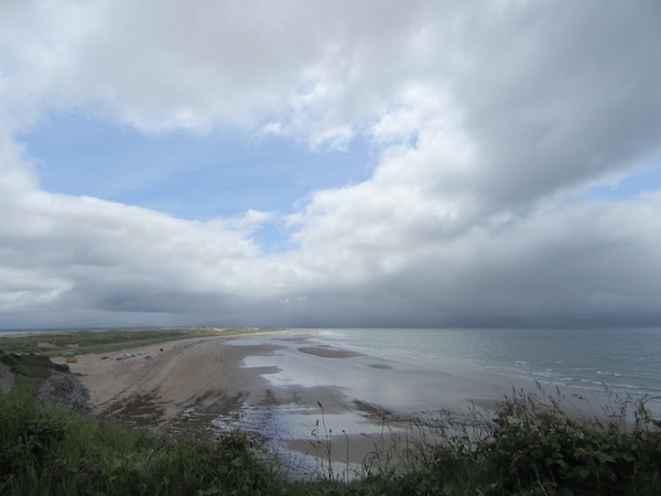
Inch strand on the way to Dingle.
Not a lot to see here, but you get an idea of the grim road ahead as you cycle into a relentless headwind.
10 June 2024
0 km - 0 m - 0' 00"

Image credit: www.failteireland.ie

The bike takes a well-earned rest today.
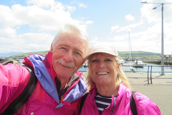
Selfie with Keelin in Dingle.
11 June 2024
107 km - 1103 m - 5' 05"

Image credit: www.failteireland.ie
Today was an epic ride in three parts.
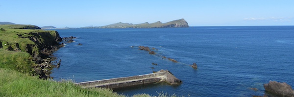
First, leaving early, there was the Slea Head Loop, heading west out of Dingle past Ventry and its beautiful beach, continuing on westward and then turning north to the headland with amazing views of the Blasket Islands, back north-east towards Ballyferriter and the Three Sisters, then north to Brandon Creek, and finally back south to Dingle.
Second, there was the ascent to Connor Pass. It's a 7 km climb with a 6% average gradient (but with lots of 8% and 9% stretches thrown in for good measure).
Third, there's the narrow, sweeping descent from the Connor Pass, followed by a long drag into Tralee with poor road surfaces that just sap one's energy.
Here is the ride on Strava.
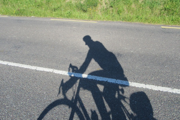
The sun was shining this morning, casting strong shadows.
Looking back east towards Dingle.
Looking southward to the Ring of Kerry.
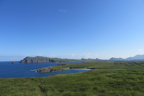
The first Wild Atlantic Way viewpoint: Ceann Sleibhe (Slea Head).
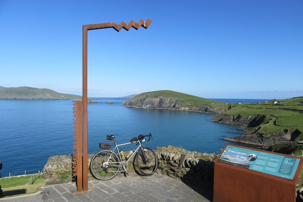
The next Wild Atlantic Way viewpoint: Radharc na mBlascaodai (Blaskets' View)
The view north to the Three Sisters.
A view west to the Three Sisters.
The view north to the Connor Pass over which I'm bound for Tralee.
The view south from the Connor Pass towards Dingle.
The Connor Pass Wild Atlantic Way viewpoint looking north.
Riding east along the north shore of the Dingle peninsula
Riding east along the north shore of the Dingle peninsula
Riding north on the Slea Head Loop.
Still riding north on the Slea Head Loop.
Riding north from the Connor Pass.
Image credit: www.failteireland.ie
12 June 2024
128 km - 876 m - 5' 20"

The rest of the ride in north Kerry was uneventful and something of a grind. There were few photo opportunities and fewer signs. I eventually made it to Tarbert, where I met up with Keelin and took the ferry to Killimer in County Clare.
The final leg from Killmer, through Kilrush, to Carrigaholt was slow and painful due to the strong headwind and very rough road surface.
Tomorrow won't be much better, with rain forecast and the promise of more rough roads. With good fortune, the wind will be a following one. I live in hope. Next stop, Doolin.
Here is the ride on Strava.
Image credit: www.failteireland.ie
The wind turned out to be an unreliable friend, as it veered to the west and became mostly a challenging cross-wind and, especially leaving Lahinch, a familiar headwind.
I had forgotten that the Cliffs of Moher lay ahead, between me and my destination at Doolin. Cliffs, are, by very definition, at the top of a hill. These imposing cliffs, of which I saw nothing, meant a wet, steep climb, before the descent to Doolin. A Doolin that bears little resemblance to Doolin the last time I was here with Keelin, forty-three years ago.
Here is the ride on Strava.
Image credit: www.failteireland.ie
Here is the ride on Strava.
Image credit: www.failteireland.ie
Unfortunately, the road west out of Galway was 20 km of busy traffic and nothing to look at, other than the next bad patch on the road.
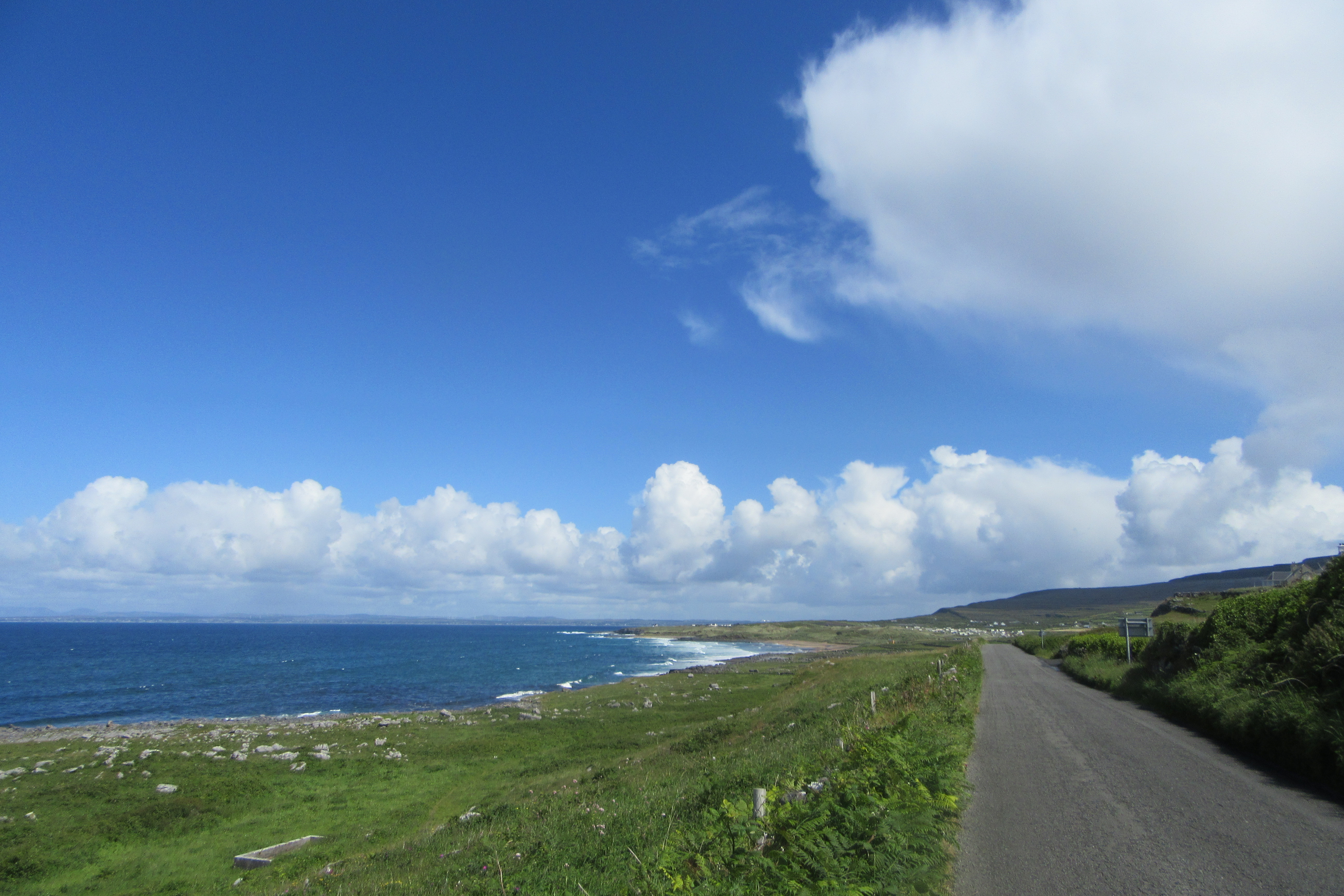
Turning north after 41 km at Baile na hAbhain, I entered true Connemara, a region in the west of Ireland, in the province of Connaught, that is bleak, barren, and boggy. If you want wild, this is it.
Turning west again, the Twelve Bens (Na Beanna Beola in Irish) loomed in the distance. These twelve hills are familiar foes. Several years ago, I had tried to traverse six of them - the Benlettery Horseshoe - but had to turn back half way after my nerve failed me on the ridge between Bencollaghduff (Binn Dubh) and Bencorr (Binn Chorr). My nerve held the next year when I returned to try again. These Twelve Bens loomed large for the rest of the ride.
Half way, I changed plan and, instead of taking a short-cut for Clifden to save energy for tomorrow's ride to Westport, I opted not to leave the Wild Atlantic Way route and follow it away from my destination in Clifden, heading towards Carna and back in a U-shaped loop. That decision was a wise one, despite the extra 25 km or so, because the next short-cut turned out to be a false friend.
Later on, I opted not to take another U-shaped loop to Roundstone and took a short-cut to Clifden. They say there are no short-cuts when hill-walking, and it seems it's the same when cycling. My short-cut took me over the most challenging terrain, through an upland bog, exposed to a vicious headwind. I had to ride a 34-31 gear on a level road just to keep moving. The wind would blow you backwards if you stopped pedalling. On the other hand, you see things at 7 km/hr that you don't see at 17, 27, or 37 km/hr. Red mist, mostly.
Long day; one more before rest in Westport.
Here is the ride on Strava.
Image credit: www.failteireland.ie
Presented with the same choice to take yet another detour, very shortly after rejoining the main road to Westport, there was little option but to make another counter-intuitive left turn. While not as dramatic as the Sky Road, the loop out the Renvyl peninsula was another highlight of the day.
Testing my resolve once again, yet another sign to turn left and take the scenic route away from the direct route to Westport presented itself at Letterfrack. Another wonderful loop ensued, bringing me back to the main road to Wesport. I was fortunate that, just before completing that loop and rejoining the main road, Keelin pulled up in the car and asked me if I was okay. I revealed that Google Maps had given me an alternative route north-east and that I was about to take it. Sense prevailed though, and I took Keelin's advice not to be distracted and just follow the route. Thank goodness.
The road to Leenaun was super, bringing me to the final decision of the day: to take a 33 km short-cut on the main road to Westport or to double-back at Clog and take one final loop north and west along the coast road. With 64Km done, and a minimum of another 40 km left, I took the short-cut, based partly on Keelin's report that the coast road, which she had taken, wasn't so great. As always, road short-cuts are designed for vehicles with engines, and the last 33 km to Westport was something of a grind. But, arriving in Wesport, it was worth every pedal-turn.
Here is the ride on Strava.
Image credit: www.failteireland.ie
Image credit: www.failteireland.ie
However, everything changed when I stopped before the downhill to Keel, when, unexpectedly, Keelin pulled over behind me. Our destination was Keem Bay, at the far west of the island. Unfortunately, between me and Keem Bay lay a steep climb and a steep descent (with the prospect of exactly the same in reverse as I rode back to Mulranny). But, nevertheless, we agreed to meet up at Keem Bay, and so we did.
The reward was immense, both in terms of cycling highs and visual highs (and a very welcome capuccino ... thanks, Keelin). I'll let the photos and the videos below tell the rest of the story.
But there is a something else. Riding back, instead of riding on the road, I opted to take the Great Western Greenway from Achill Sound to Mulranny. What a delight. It was more sheltered, the surface was impeccable, and views north and east made cycling today what it supposed to be: meditation in motion. I didn't want the ride to end.
Here is the ride on Strava.
Image credit: www.failteireland.ie
Here is the ride on Strava.
Image credit: www.failteireland.ie
Here is the ride on Strava.
Image credit: www.failteireland.ie
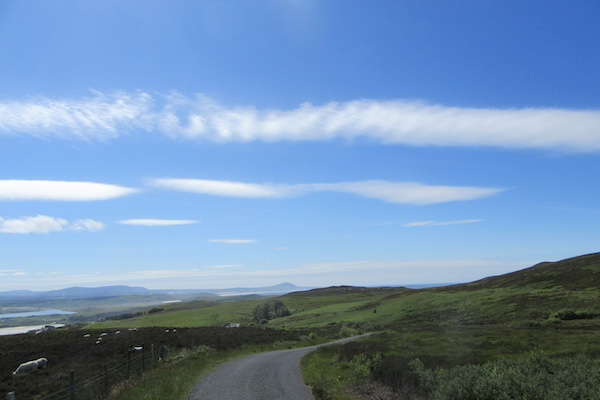
Apparently, there's a motor rally in nearby Letterkenny this weekend so I was overtaken by innumerable rally cars whose drivers seemed to enjoy blipping their throttles as they passed. Easily amused, evidently.
Here is the ride on Strava.
Image credit: www.failteireland.ie
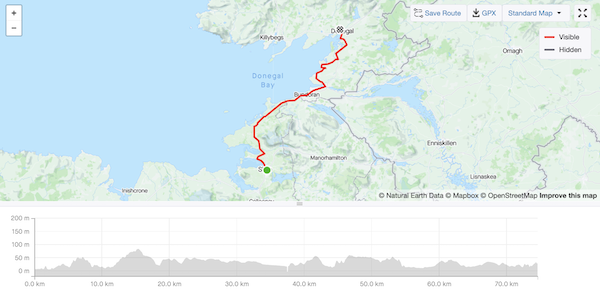
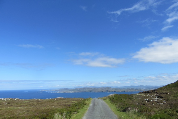
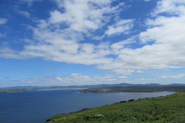
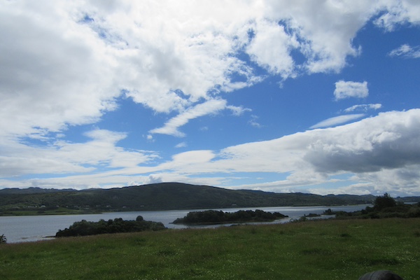
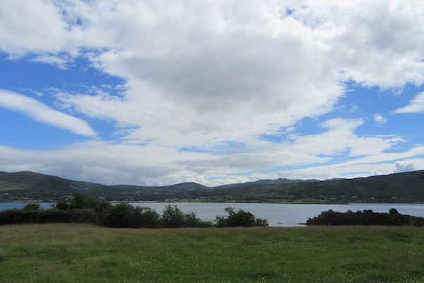
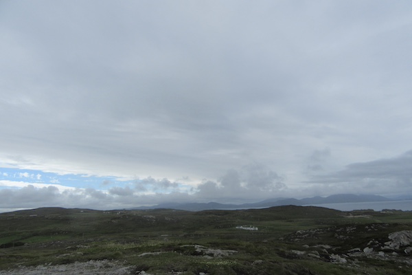
I began the day with some anticipation. I was going to revisit the roads around the town of Dungloe I had cycled two years ago with my daughter Georgina. It was then that the seeds of the idea of cycling the Wild Atlantic Way were first sown. Thankfully, yesterday's rain had abated, and I headed west from Donegal town towards Killybegs.
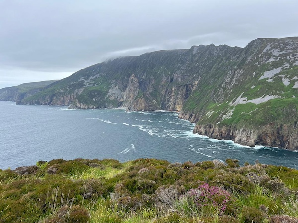
The Wild Atlantic Way takes in the west of this part of this peninsula in Donegal, including Sliabh Liag (Slieve League in English), one of the most iconic cliff headlands in Ireland. However, it requires a long detour and, conscious that there are still three challenging days ahead, I decided to head north at Killybegs and forego Sliabh Liag and, yet further west, Glencomcille, and return another day. I know I will, because Keelin did go to Sliabh Liag, and her photographs are amazing (see below).
A slow puncture approaching Ardara meant I couldn't fully enjoy the descent (still not sure, I think it was a problem with the valve, not a puncture). Nevertheless, the road out of Ardara, on a west and east loop, rather than taking the excellent road through Glenties, brought back memories. But it was when I rejoined the N56 road at Maas that the day really took off. I had previously cycled this road using the cycle path that parallels the N56, but today, having seen several walkers and young children learning to ride on it, I decided the main road was justified. What followed, with a tail wind, was a glorious, testing, and quite quick ride up and over hills all the way to Dungloe.
A leisurely ride to Burtonport provided a perfect end to a day I had anticipated so much.
Here is the ride on Strava.
And now, for some more inspirational photography, here are just a few of the amazing photos that Keelin took on her version of the Wild Atlantic Way.
Image credit: www.failteireland.ie
Riding north past Gweedore to Bloody Foreland, the day changed and the ride took on a different character altogether. These are not flat roads, but each up-and-over rewards you in so many ways. The photos below tell the story, as the route takes you to Falcarragh and on the Dunfanaghy, my destination.
As you approach Dunfanaghy, there is an option to take the Horn Head road. Keelin had driven it earlier and her reports were very motivating. I hadn't studied the map properly before starting out, and decided to take the left turn and see what Horn Head held in store. Well, it was the steepest climb yet, with many 12% - 14% ramps, but the reward was the best vista yet on the Wild Atlantic Way. The descent was, of course, just as steep, so I was glad my brake blocks held out, as well as the wheel rims which were in danger of overheating. But the views on the descent were simply amazing.
Riding back through Dunfanaghy and on to Marble Hill Beach was a pleasure. What a day. Yes, Donegal delivers.
Here is the ride on Strava.
Image credit: www.failteireland.ie
Here is the ride on Strava.
Image credit: www.failteireland.ie
Malin Head can't match Horn Head for spectacular views, but it did its best to compete with short sharp ramps that tested the legs. I was glad I had a relatively easy day yesterday to recover after the exertions on Horn Head. The road as you approach Malin Head is a loop so that you approach the Head from the west. I had intended returning the way I came, but after riding this western half of the loop, I changed my mind and decided to carry on to the eastern half. It couldn't be as difficult, could it? Happily, it wasn't and provided super vistas to the east, before rejoining the road south.
A few kilometers later, the Wild Atlantic Way heads further east to the coast but, with a long drive back to Dublin once I reached Muff, I decided I had seen enough headlands, enough coastal views, and ridden enough ramps. So, I settled into an enjoyable 40 km ride south, finally confident that I would reach my destination.
Here is the ride on Strava.
Epilogue
When I was 15 years old, I cycled from Cork to Kerry to meet a school friend, Philip Blennerhasset, and we cycled the Ring of Kerry (The Iveragh Peninsula), as well as taking the same Tarbert Ferry I took on Day 9 from Kerry to Clare, before returning to Cork. We did this with a heavy canvas tent strapped to a carrier on five-speed bikes. I decided that summer that, some day, I would ride around Ireland on a bike, and I spent the winter crafting an upside-down U-shaped wooden box that would work as panniers and tent enclosure (I didn't know about panniers in 1973). It must have weighed as much as the bike, unladen. Thank goodness that ill-conceived plan never saw the light of day.
But the dream remained over the intervening years, and, while the Wild Atlantic Way is not a loop around Ireland, it's more than enough. The experience of seeing so much of the west coast of Ireland, up close and personal, as only cycling can allow, was better than I could ever have dreamed it to be.
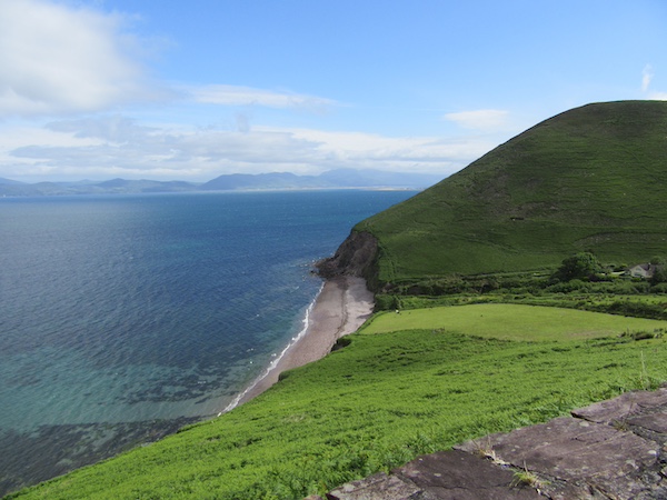
But the West I cycled over fifty years ago has changed. It is still wild, make no mistake, but there are fewer instances of the remote wilderness I recall from that time. The Beara Peninsula on Day 3 and Day 4, Connemara on Day 12, and the expanse of north-west Mayo on Day 16 are the standout exceptions. For sheer take-your-breath-away cycling beauty, the highlights of the past three weeks are the hills north of Allihies on Day 4, Slea Head in Dingle on Day 11, Keem Bay on Achill Island on Day 15, and, of course, Horn Head on Day 20.
But this does a disservice to the Wild Atlantic Way. In its entirety, it is nothing short of spectacular, with innumerable challeges and rewards. I hope the photos and videos give you some impression of all it has to offer.
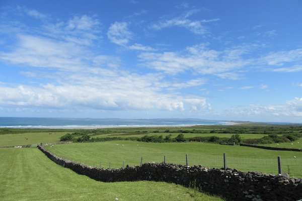
On the way west to Fenit.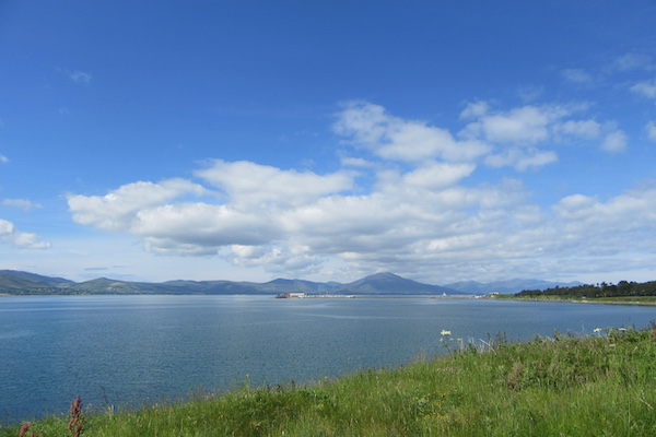
The view approaching Fenit.
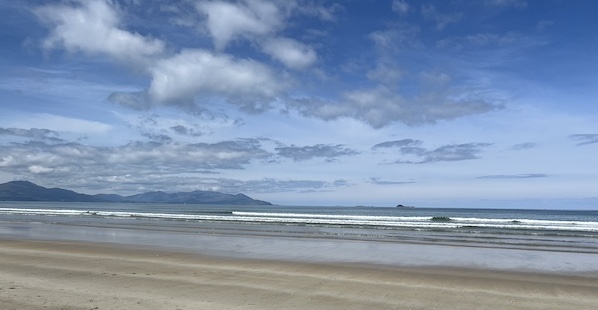
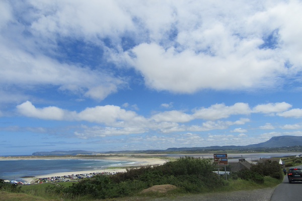
Banna strand
(Thanks to Keelin, who took this photo; I didn't stop after losing time on my unintentional loop from Tralee to Fenit and back).
Approaching Kilrush in Co. Clare.
Still approaching Kilrush in Co. Clare.
13 June 2024
108 km - 1133 m - 5' 14"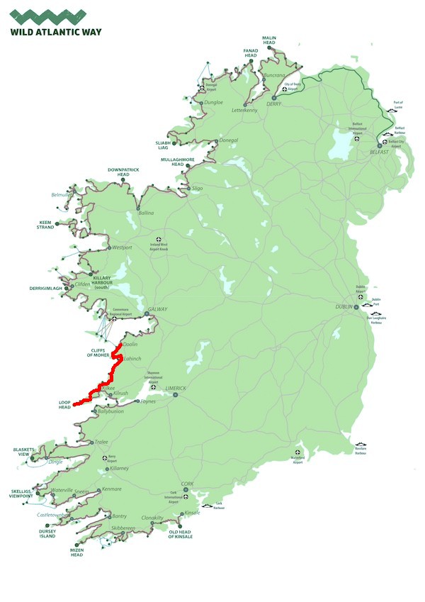
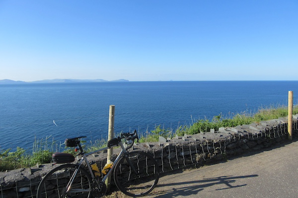
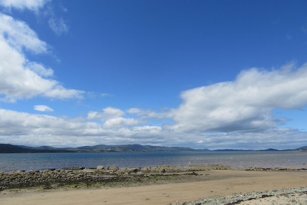
On the way to Loop Head from Carrigaholt.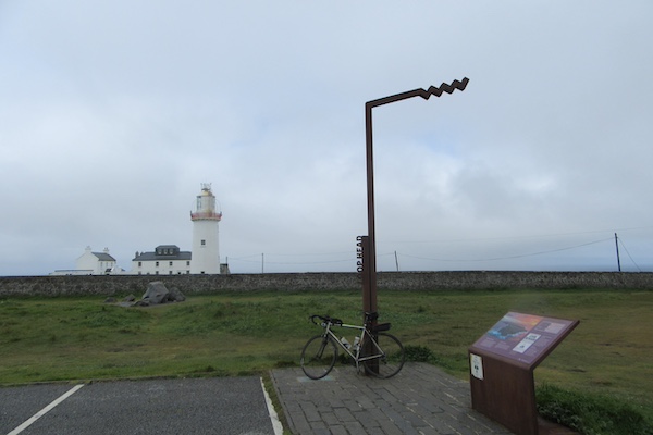
Loop Head.
Much of the Wild Atlantic Way follows the EuroVelo 1 route.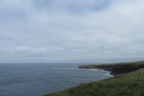
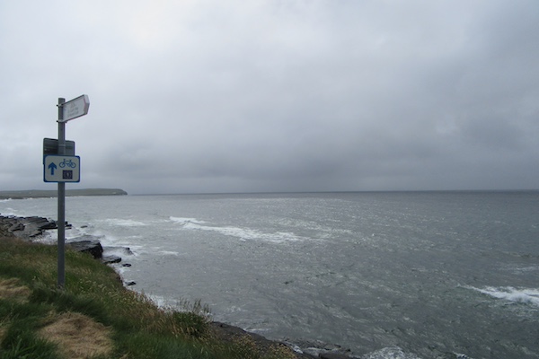
Riding along the Kilkee Cliffs.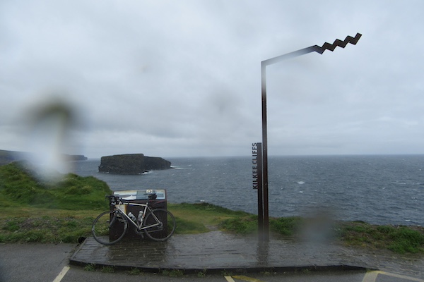
The Kilkee Cliffs Wild Atlantic Way Viewpoint.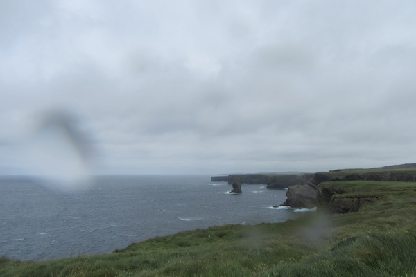
Riding along the Kilkee Cliffs.
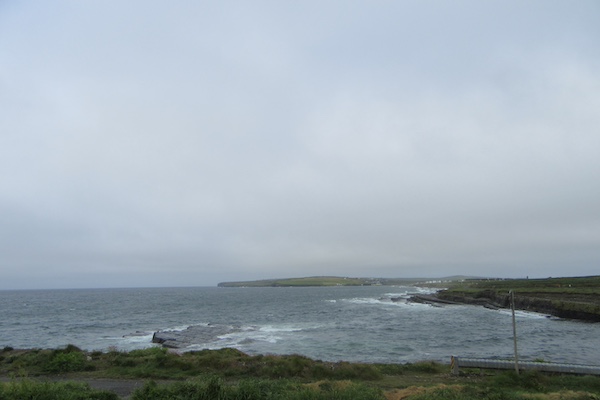
Approaching Lahinch.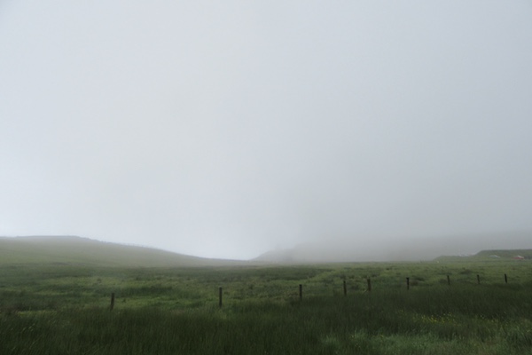
These are not the Cliffs of Moher ... this is what you see as you ride over the steep headland that leads to the cliffs of Moher: very little.
Nothing much to see here, but everything to experience ... this is indeed the Wild Atlantic Way.
On the way to Loop Head, battling a strong headwind.
Loop Head, at last.
14 June 2024
70 km - 644 m - 3' 03"
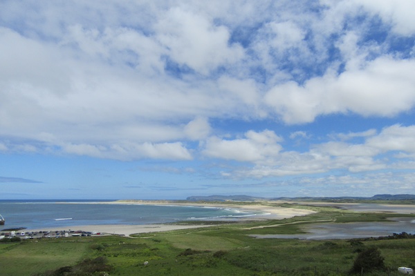
The view north east, riding to Black Head.
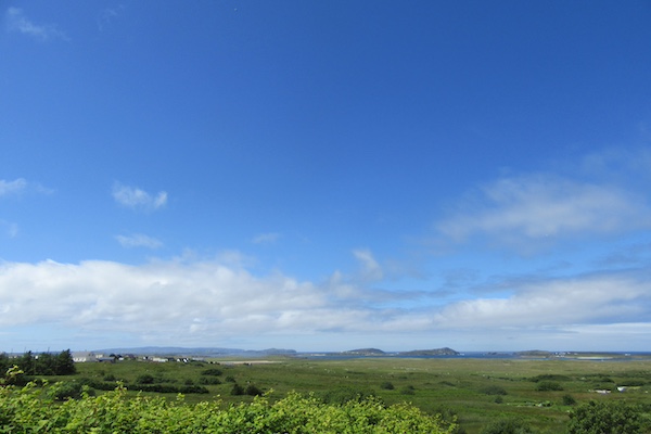
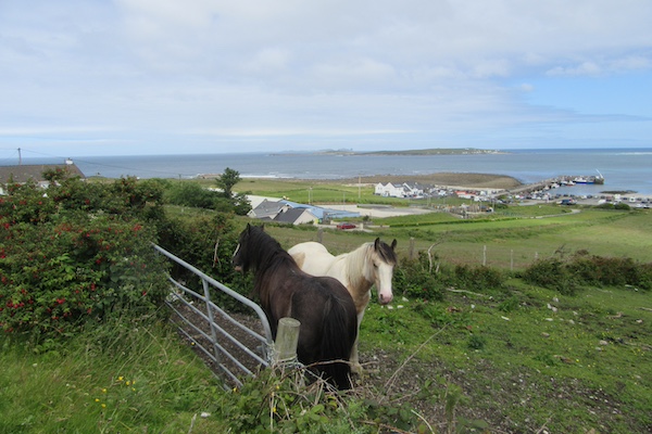
The Murrooghtoohy viewpoint, looking west, at Black Head. You can just about make out three islands in the distance. These are the Aran Islands, from left to right: Inisheer, Inismaan, and Inismore (or Inis Oirr, Inis Meain, and Inis Mor, as Gaeilge, for east island, middle island, and big island, if memory of my limited Irish serves me well).
Looking back west from where I came this morning as I approached Kinvarra.
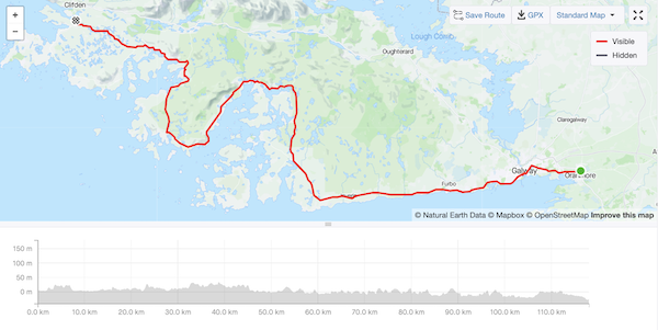
15 June 2024
118 km - 854 m - 5' 24"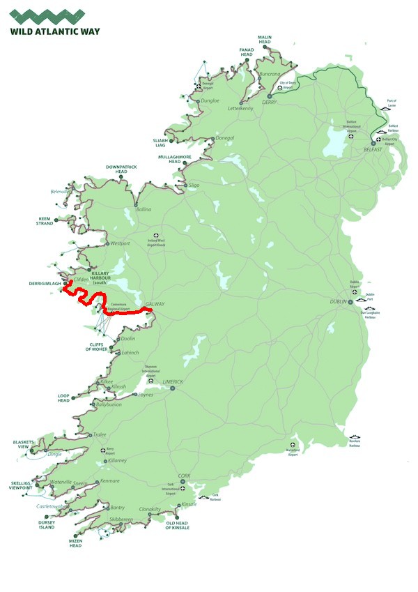
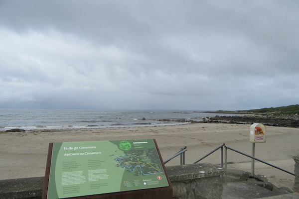
Entering Connemara, another of Ireland's Gaeltachts: native Irish-speaking regions. 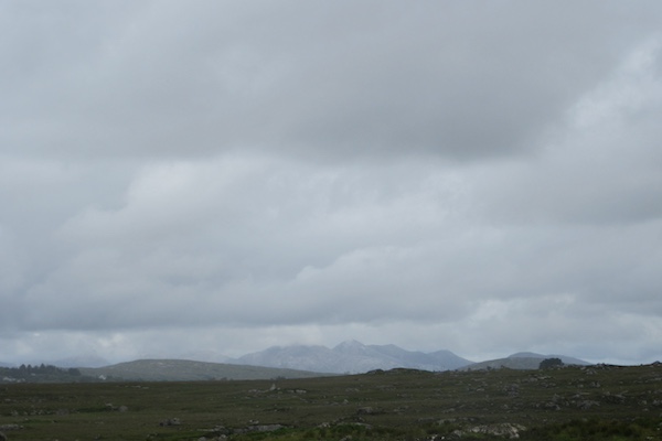
The Twelve Bens (or, sometimes, the Twelve Pins) loom large in the distance.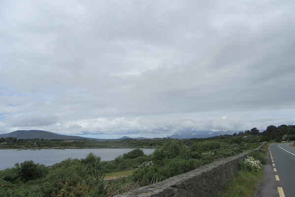
The Twelve Bens ... still there.
They just won't go away.
Some relief: heading south-west to Carna.
They're back!
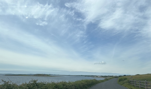
Some seascape, for a change.
More seascape.
Wouldn't you know it: the Twelve Bens, from a different aspect as I head north-west again, after leaving Carna.
This view of my short-cut just does not do it justice: it is wild and wearying. 10 km to go.
16 June 2024
103 km - 1971 m - 4' 40"
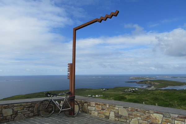
The Sky Road viewpoint. 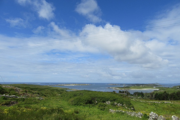
Descending from the top of the Sky Road loop.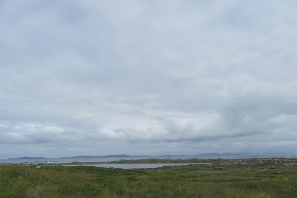
The view towards the next loop.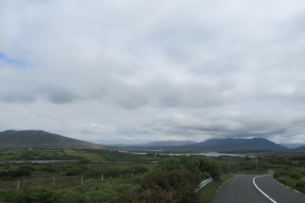
Riding eastwards on the second loop.
Riding eastwards on the second loop.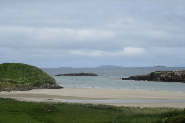
Now on the third loop.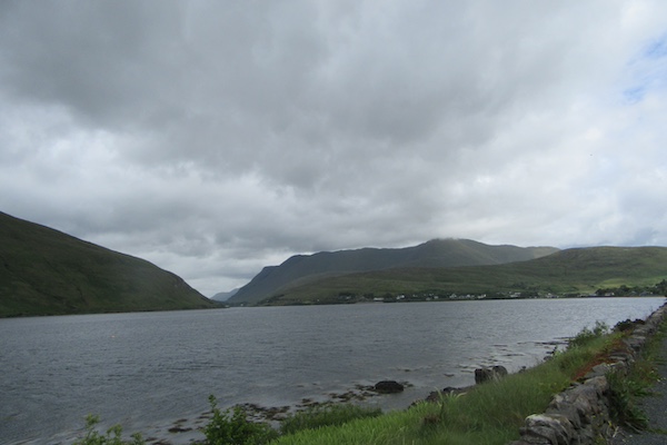
Almost at the end of the third loop.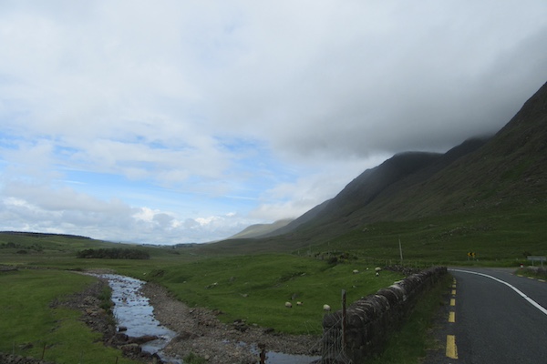
Finally on the way to Westport.
Approaching Westport, you can see Croagh Patrick , a pilgrimage climb, sometimes done barefoot, in the distance.
Approaching the Sky Road viewpoint
Descending eastwards on the second loop.
17 June 2024
0 km - 0 m - 0' 0"
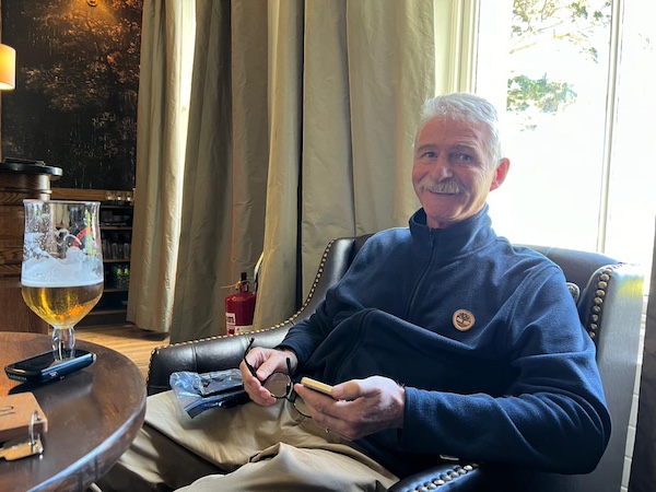
Enjoying some down-time.
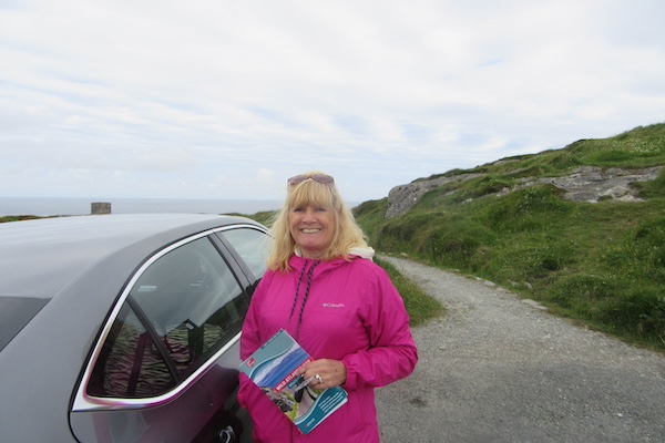
With Keelin.
18 June 2024
103 km - 1219 m - 5' 09"
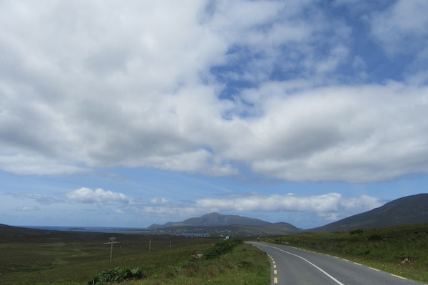
My one photograph riding west towards Achill Island. 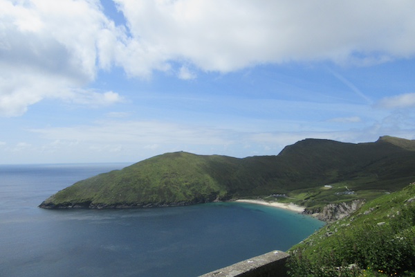
Keem Bay from the top of the ascent from Keel.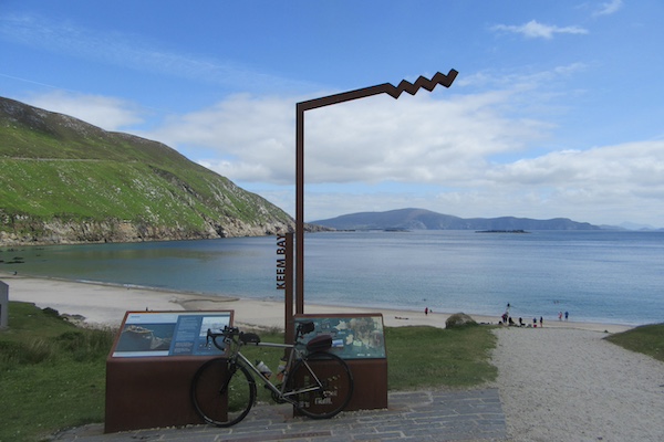
Keem Bay.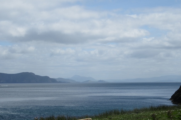
The view south east from Keem Bay. The distant mountain is Croagh Patrick.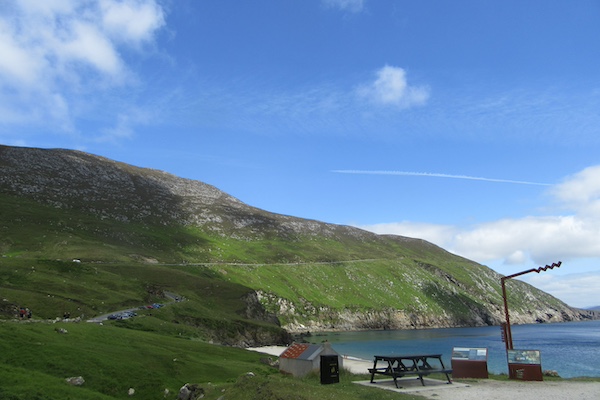
Looking back up at the road I just descended, and now had to ascend. Never trust in average gradients.
This ascent was probably a manageable 8%-9%, but the 14% ramps required focus.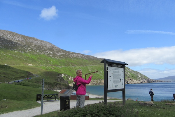
Keelin at Keem Bay.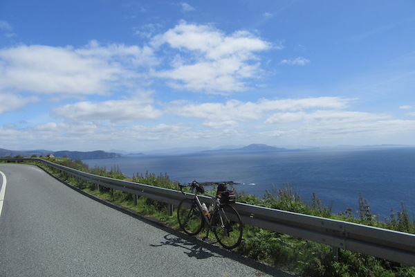
The view south east from the top of the climb.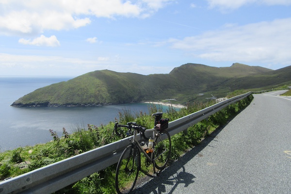
And the view back to Keem Bay.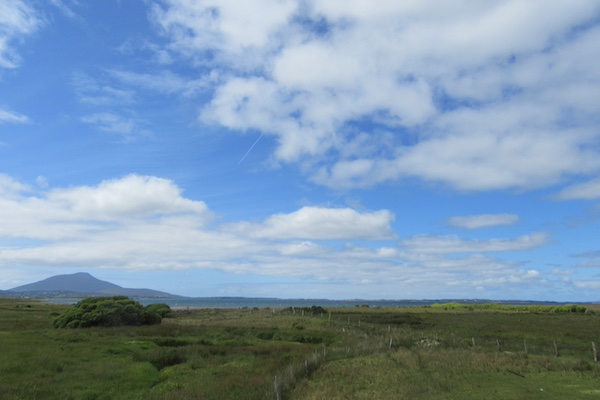
Some views north east. 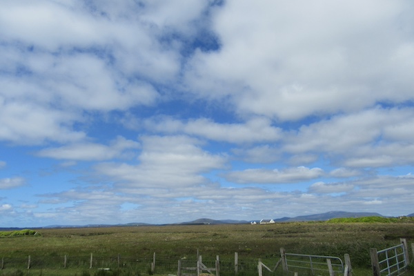
More views north east.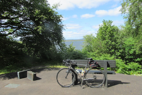
Stopping on the Great Western Greenway.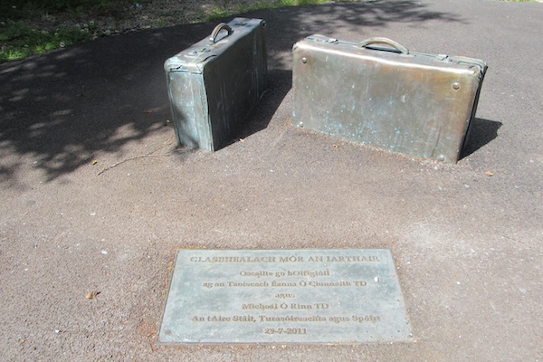
Glasbhealach Mór an Iarthair: The Great Western Greenway, as Gaeilge.
The view south from where we are staying tonight, with Croagh Patrick in the distance.
Colour coordination personified.
Riding west towards Achill Island.
Descending to Keem Bay.
Descending back to Keel.
The wonderful Great Western Greenway.
19 June 2024
73 km - 649 m - 3' 10"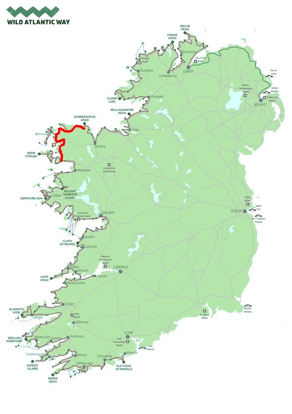
The view west towards Achill Island. 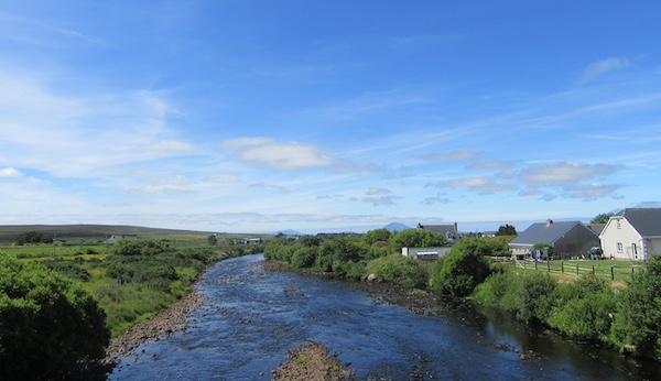
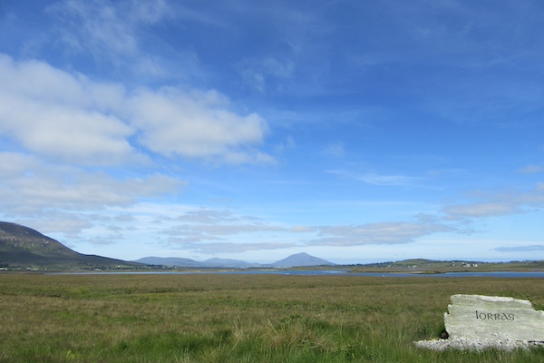
The river from the bridge in Bangor-Erris (the English spelling of Iorras, which how it is spelled in Irish in the photo above).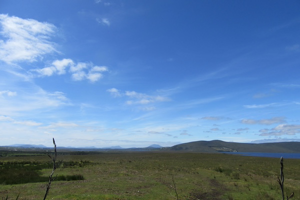
Achill Island is far in the distance now.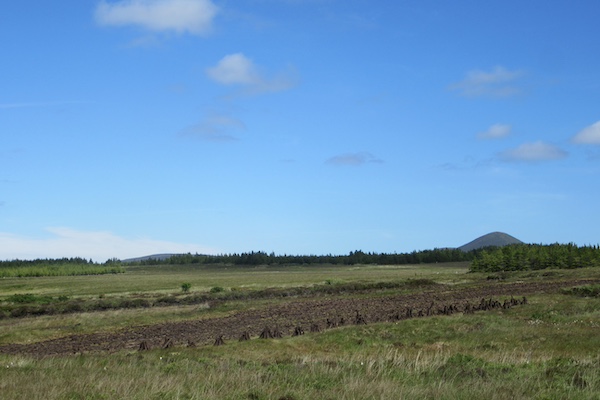
Little ricks of hand-cut peat drying in the sunshine.
My first glimpse of the Atlantic since leaving Mulranny, three or so hours ago.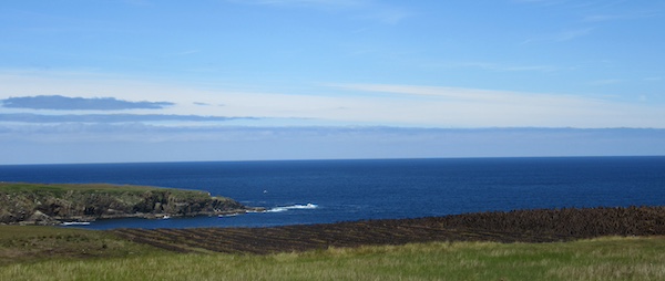
Another peat field, against a backdrop of the Atlantic. There is no land due north of here; Iceland is north-by-north-west, though.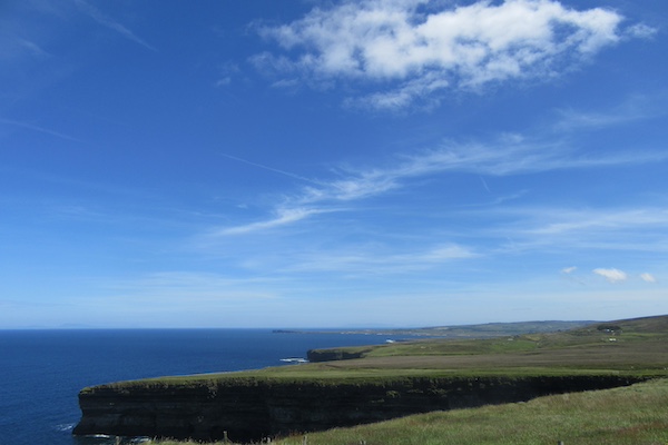
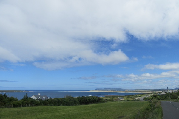
The headlands as I approach Ballycastle, our stop for the night.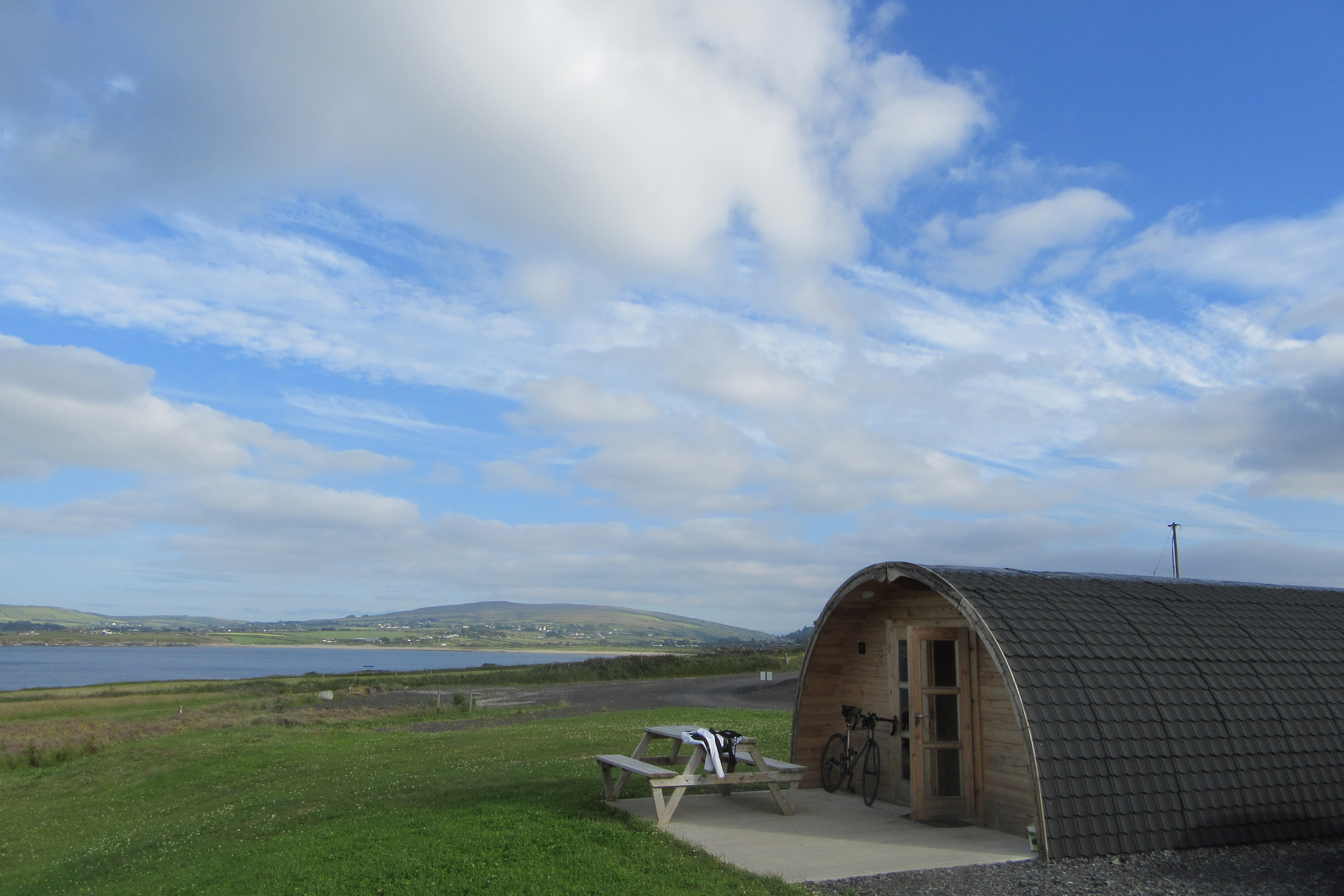
And here it is: our glamping pod.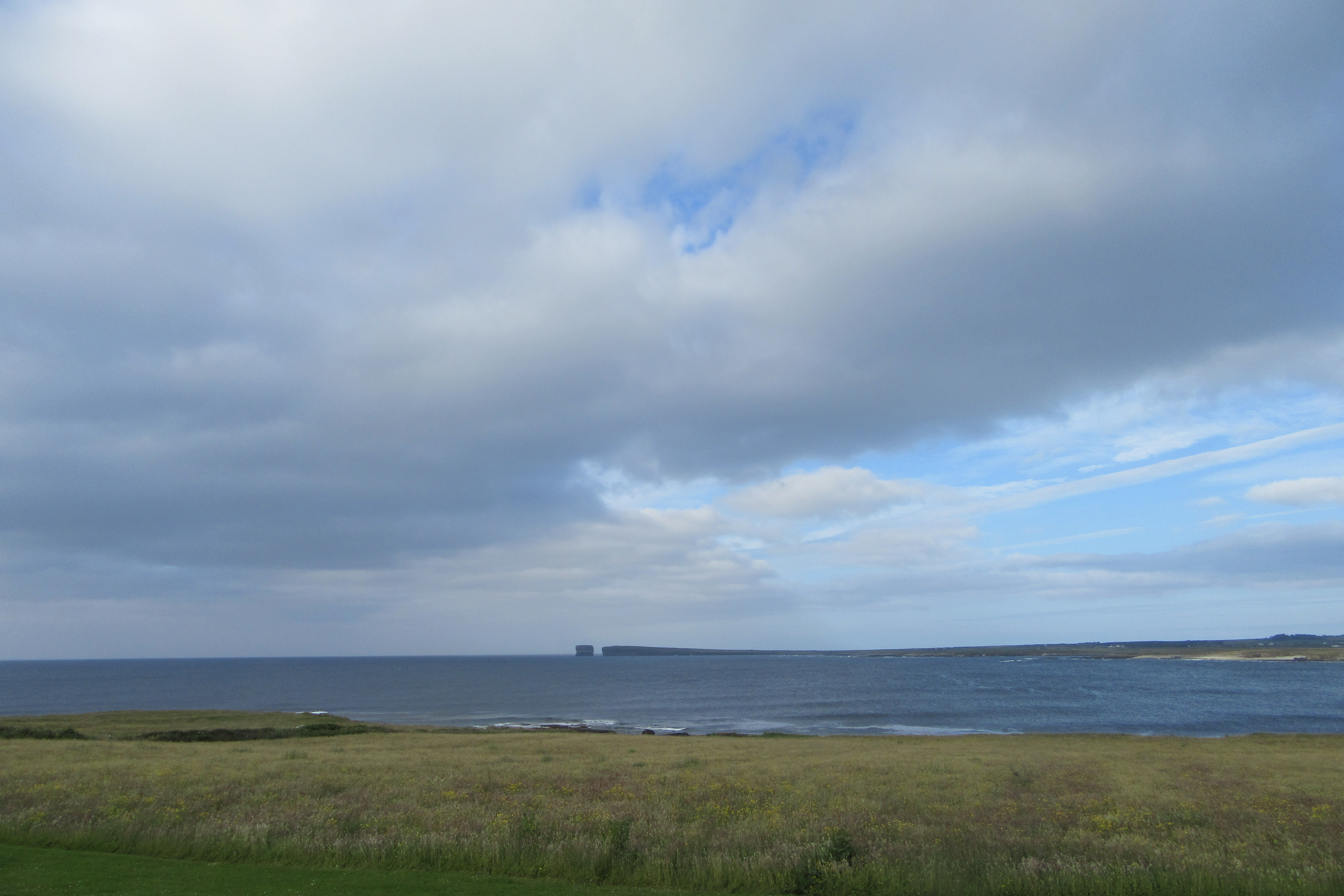
And the view from the front door.
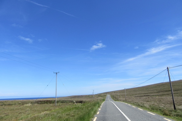
This is what most of the ride looked like.
But the final kilometers provided some stunning views north and north-east, with Donegal visible in the far distance.
20 June 2024
102 km - 864 m - 4' 33"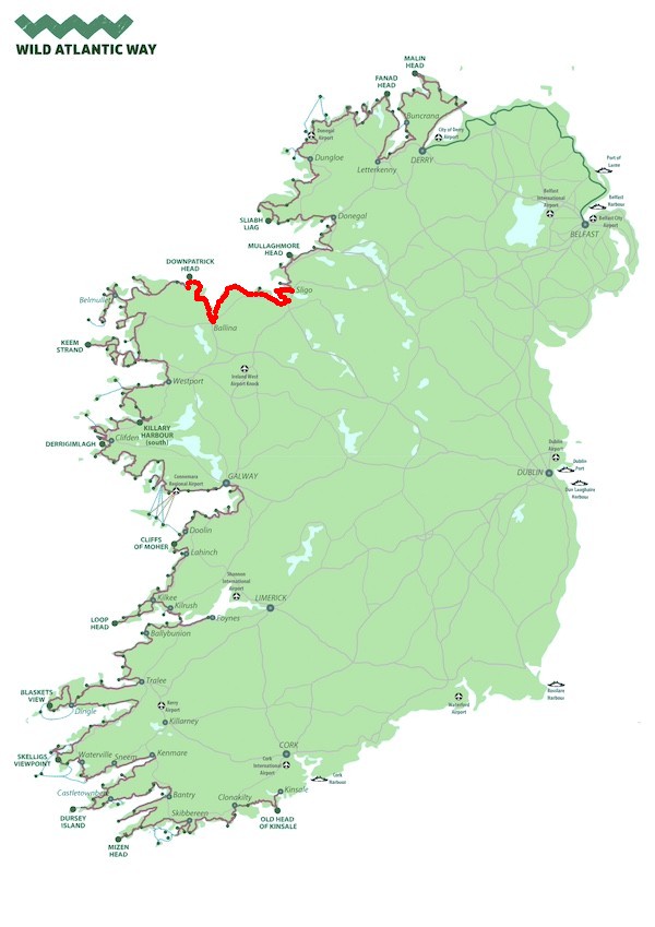
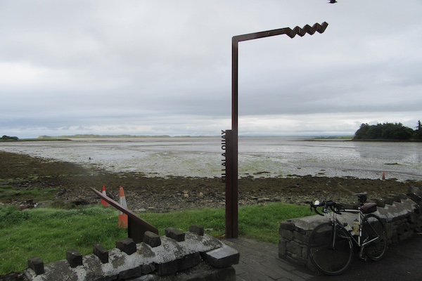
Killala Quay. Killala has a special place in Irish history, as the site of a failed rebellion in 1798 against the occupying British. 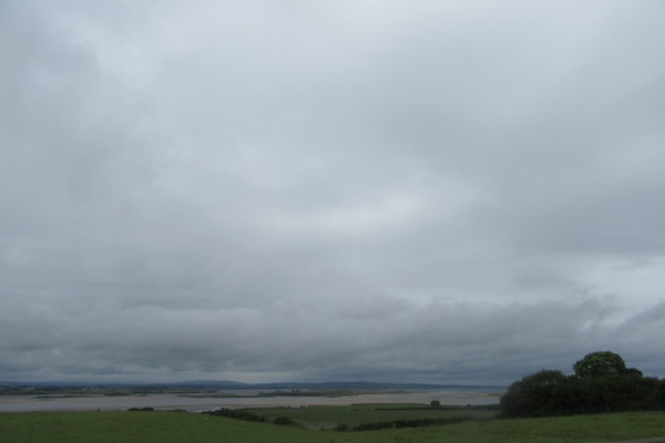
The view from Killala.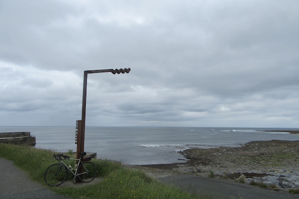
Easky Pier.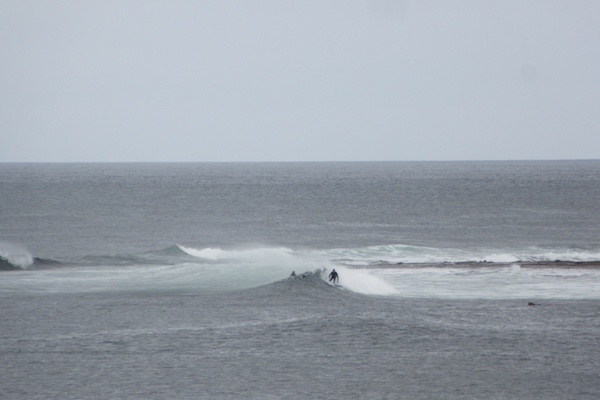
Surfers off Easky beach.
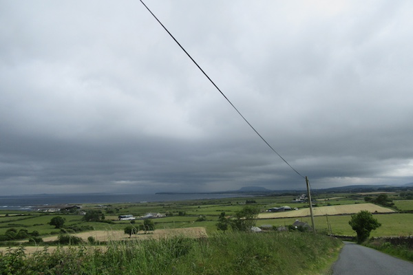
The road towards Sligo.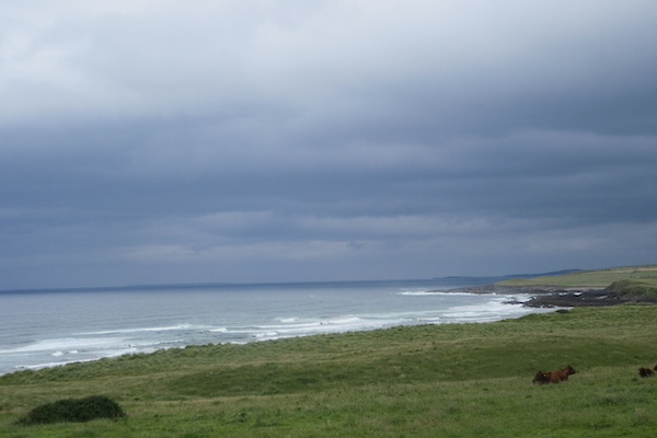
And one of the few views to the coast.
A glimpse of some of the best bits of the ride today.
(I didn't notice that my camera had been knocked out of kilter after the bike fell over earlier in the day.)
Another glimpse.
21 June 2024
75 km - 595 m - 3' 09"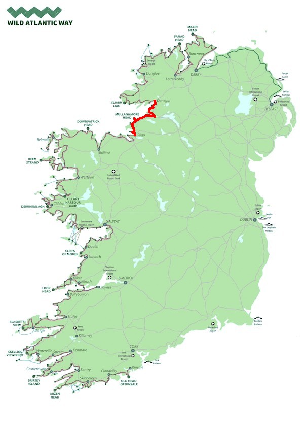

This is the only photograph I took. I can't even remember where it was.
Just one video today, capturing what it was like riding on the by-roads and then the national road to Donegal from Sligo.
Not a lot of meditation in motion going on here.
22 June 2024
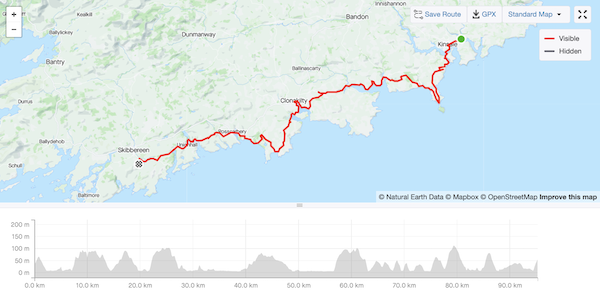
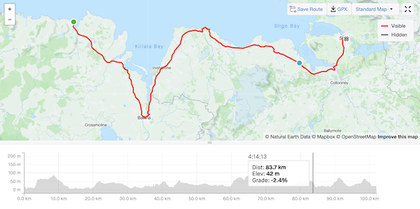
77 km - 947 m - 3'24"
A great view south to County Mayo as you ride west from Donegal.
Another view south.
Somewhere along the road ... I really can't remember where.

Same.
Same again.
Fintragh Bay.
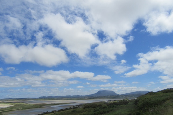
Ben Bulben in County Sligo, which I rode past in mist and rain yesterday. This is Ireland's Table Mountain.
Sliabh Liag.
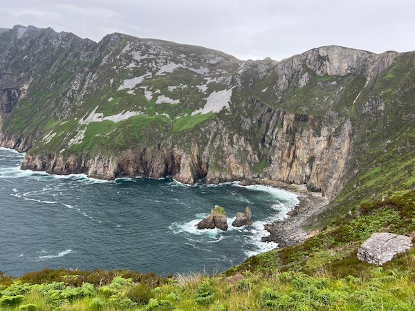
Sliabh Liag, again.
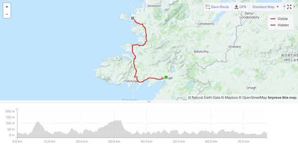
23 June 2024
87 km - 1311 m - 4' 32"
The view riding north from Burtonport.
The view riding north from Burtonport.
Carrig Finn viewpoint; shame about the white van.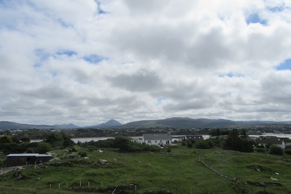
Mount Errigal in the distance.
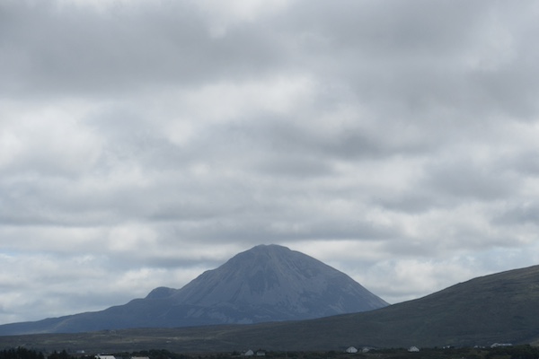
A close-up of Mount Errigal.
The views riding to Bloody Foreland.
The views riding to Bloody Foreland.
The views riding to Bloody Foreland.
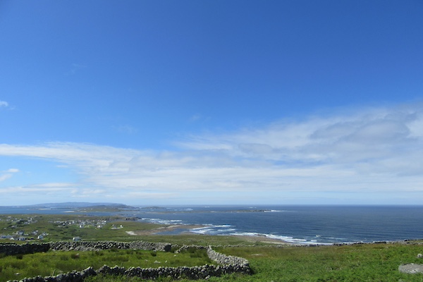
The views riding to Bloody Foreland.
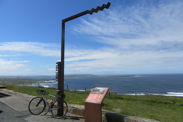
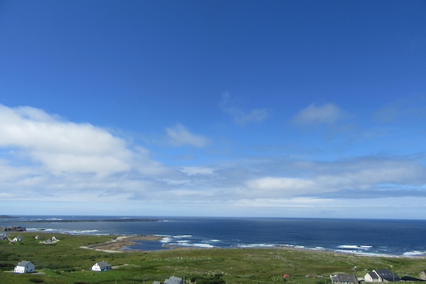
Cnoc Fola (aka Bloody Foreland) viewpoint.
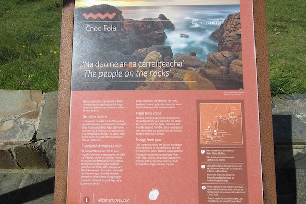
Cnoc Fola (aka Bloody Foreland) viewpoint.
The views riding east from Bloody Foreland.
The views riding east from Bloody Foreland.
The views riding east from Bloody Foreland.
The views riding east from Bloody Foreland.
The views riding east from Bloody Foreland.
The views riding east from Bloody Foreland.
The views riding east from Bloody Foreland.
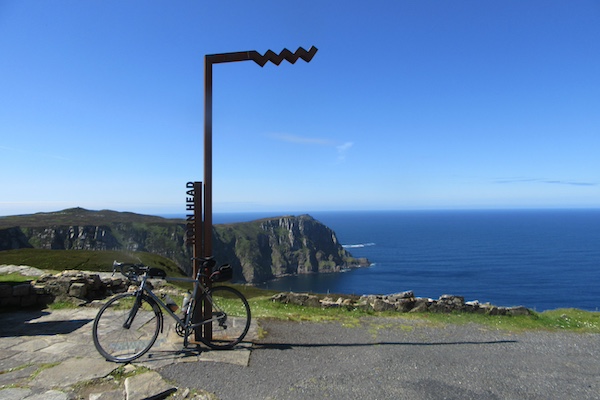
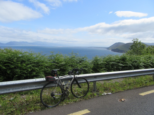
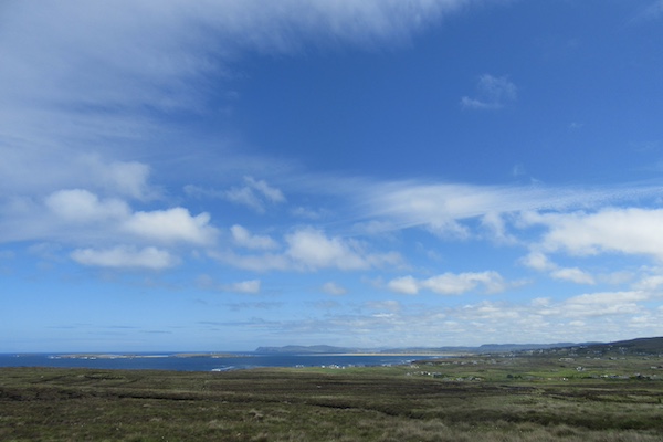
Horn head!
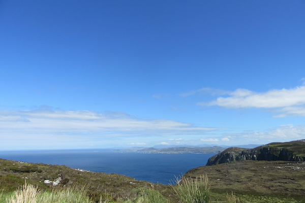
The view riding around Horn Head.
The view riding around Horn Head.
The view riding around Horn Head.

The view riding around Horn Head.
The view riding around Horn Head.
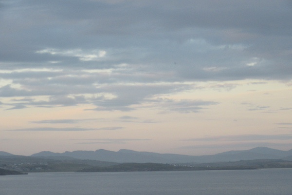
The evening view brings a great day to a close.
This will give you just a glimpse of the superb quality of the ride today. The bike fell earlier and the camera got knocked out of kilter, hence the off-vertical aspect.
And another glimpse.
24 June 2024
80 km - 874 m - 4' 02"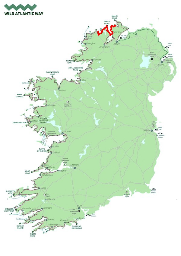
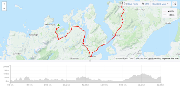
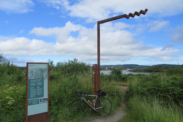
The Doe Castle Viewpoint.
Rding south to Milford.
Riding south to Milford.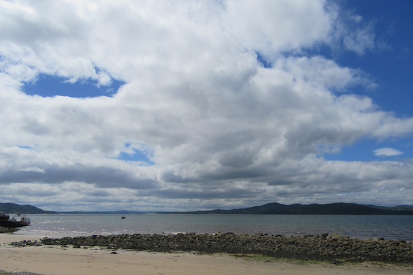
A view from Buncrana.
Another view from Buncrana
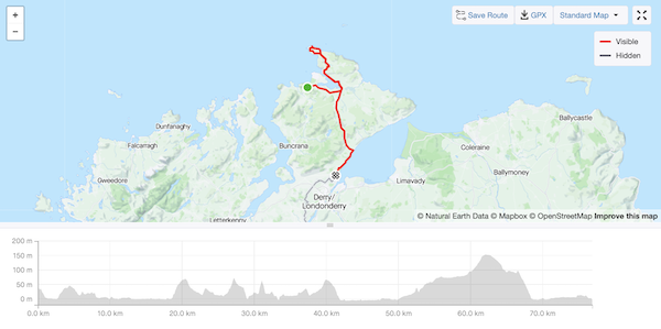
25 June 2024
72 km - 715 m - 3' 26"

The view north-east leaving Ballyliffin.
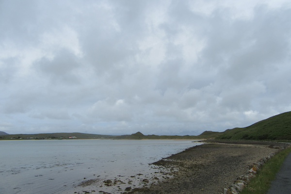
Another view leaving Ballyliffin.
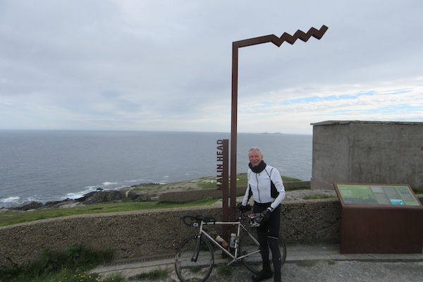
The Wild Atlantic Way viewpoint at Malin Head, the most northerly point in Ireland.
(Mizen Head, visited on Day 2, is the most southerly point in Ireland.)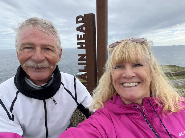
Keelin and myself at Malin Head.
A view from Malin Head.
Another view from Malin Head.
Yet another view from Malin Head.
Keelin at Malin Head.
A view north leaving Malin Head.
Another view north leaving Malin Head.
Yet another view north leaving Malin Head.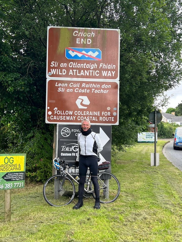
The end of the Wild Atlantic Way in Muff, County Donegal.
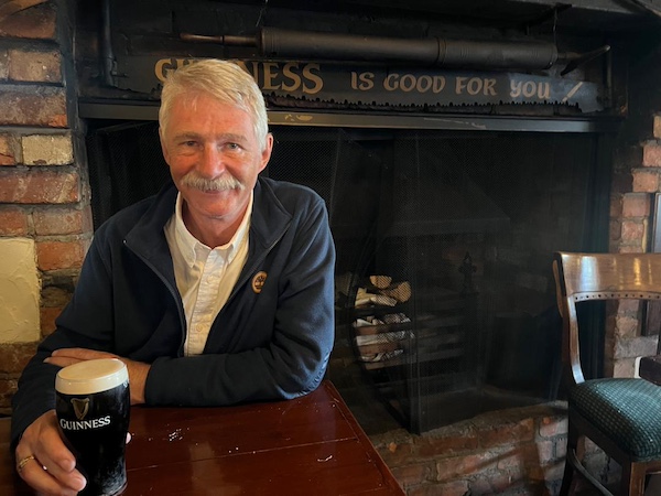
The reward at the end of the journey.
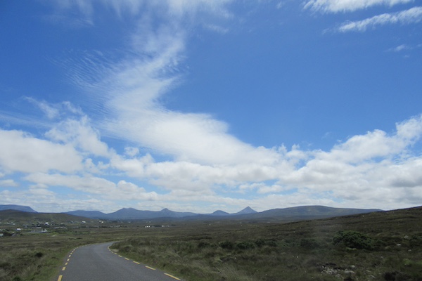
The road early today.
And now we turn inland towards Malin Head.
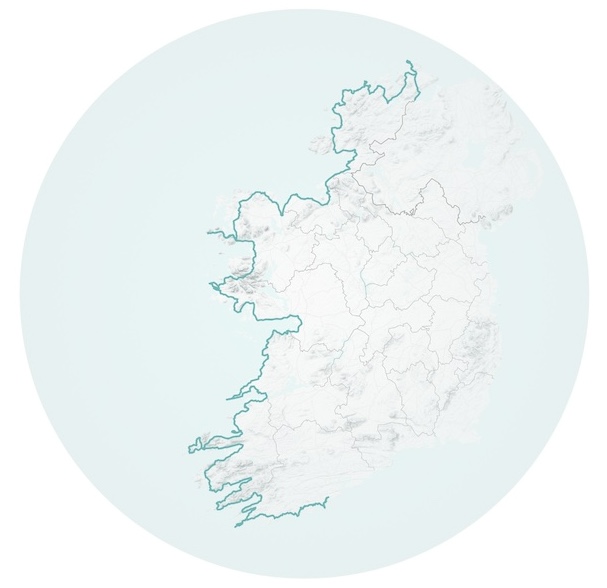
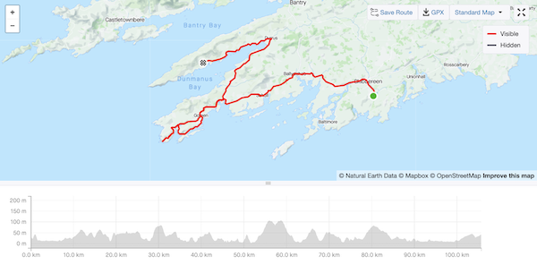
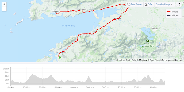
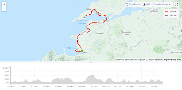
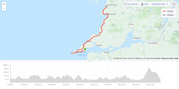
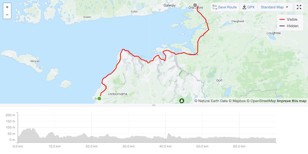
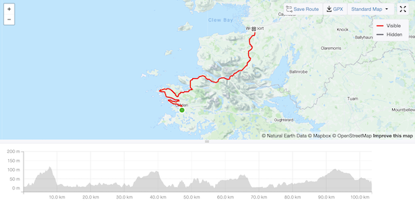
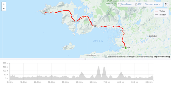
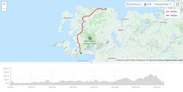
Map produced from GPX data of the ride by The English Cyclist